
Ai Content Generator
Ai Picture
Tell Your Story

Timeless Treasures of the Sea: The Enduring Allure of Vintage Nautical Maps
The open seas have long captivated the human imagination, not merely as barriers between lands but as vast canvases of possibility. For centuries, sailors, explorers, and cartographers poured their collective wisdom into the creation of nautical maps, not just as navigational tools but as rich records of maritime knowledge. Among the most fascinating relics of seafaring history are vintage nautical maps—artifacts that have transcended their original function to become prized collectibles, historical touchstones, and decorative masterpieces.
Origins of Nautical Mapping
The roots of nautical cartography can be traced back to ancient civilizations like the Greeks, Phoenicians, and Arabs, who pioneered early forms of sea navigation using stars and rudimentary drawings. However, it was during the Age of Discovery, from the 15th to the 17th centuries, that nautical maps evolved dramatically in both accuracy and artistry. European explorers such as Vasco da Gama, Christopher Columbus, and Ferdinand Magellan relied heavily on these charts to traverse unknown waters. The demand for increasingly accurate maps gave rise to specialized cartographers, who meticulously detailed coastlines, islands, and ocean currents.
Art Meets Navigation
One of the most striking aspects of vintage nautical maps is their intricate artistry. These maps are more than mere guides—they are works of art. Decorative borders, elaborate compass roses, fantastical sea monsters, and detailed ships populate the surfaces of these maps, turning them into visual narratives of exploration and conquest. These illustrations served both symbolic and practical purposes: they reflected the mapmaker’s creativity while warning of unknown dangers.
The materials used, including hand-laid paper, vellum, and parchment, along with inks made from natural dyes, add a distinct tactile and visual quality to vintage maps. Each line drawn was an act of precision, each embellishment a tribute to the mystique of the sea.
The Golden Age of Nautical Cartography
The 16th to 18th centuries marked the Golden Age of nautical maps. During this period, maritime nations like Spain, Portugal, the Netherlands, and Britain vied for global dominance, and maps became essential tools in the race for colonies, trade routes, and maritime supremacy. Portolan charts, one of the most famous types of early nautical maps, emerged during this time. These charts were characterized by their detailed coastlines, radiating compass lines, and lack of interior geography. They were highly prized by sailors for their precision and clarity.
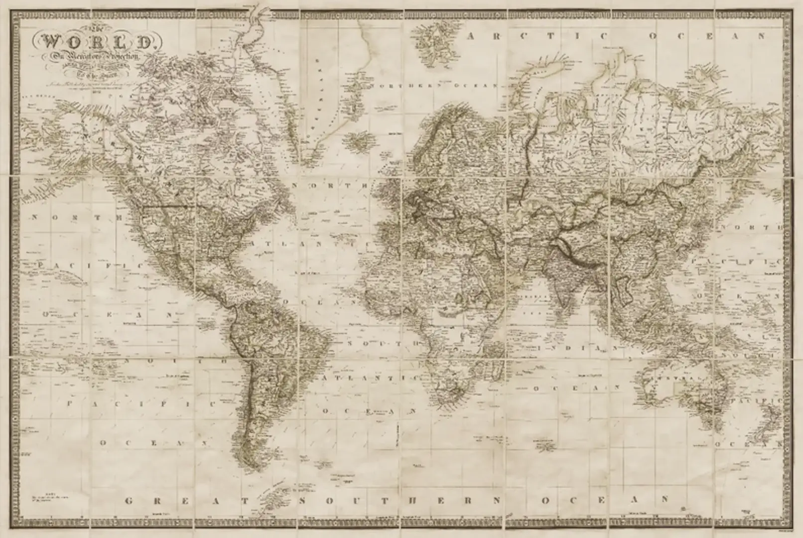
Mapmakers such as Gerardus Mercator, Abraham Ortelius, and Johannes Blaeu became household names among navigators and intellectuals alike. Mercator’s projection, for example, revolutionized nautical mapping by introducing a system that allowed for easier course plotting using straight lines. Such innovations not only aided navigation but also contributed to the scientific understanding of the world.
Symbolism and Storytelling
Vintage nautical maps are more than navigational instruments—they are storytelling devices. They document the zeitgeist of their era, capturing beliefs, fears, and aspirations. Sea monsters and mythological creatures depicted in the margins reflected the uncertainty of uncharted territories. Allegorical figures, such as Neptune and mermaids, echoed maritime folklore and religious symbolism. Maps often included annotations and legends that offered insights into the geopolitical climate, such as colonial disputes or maritime treaties.
Many vintage maps also bore the personal marks of the explorers who used them. Handwritten notes, plotted routes, and weather annotations offer a deeply personal glimpse into the experiences of those who charted the seas. This makes each vintage nautical map a unique historical document, rich in character and nuance.
The Collector’s Passion
Today, vintage nautical maps hold immense value among collectors, historians, and art enthusiasts. Their worth is not measured solely in monetary terms, but in their cultural, aesthetic, and historical significance. Serious collectors often seek out maps from specific eras or regions, such as early Mediterranean charts, colonial-era Atlantic maps, or Pacific exploration charts.
Authenticity is a key concern in the world of map collecting. Expert appraisals consider factors like the map’s condition, printing technique, paper type, and watermark. Provenance—the map’s ownership history—also plays a crucial role in establishing authenticity and value. Some rare maps, especially those with historical annotations or from famed cartographers, have fetched significant sums at auctions and private sales.
Decorative Appeal and Modern Use
Beyond their historical importance, vintage nautical maps are admired for their visual elegance. They have become popular decor elements in homes, offices, and commercial spaces. Interior designers often incorporate them into nautical-themed rooms, libraries, or executive offices to evoke a sense of adventure, intellect, and timeless beauty. Whether framed on a wall or printed on textiles, these maps serve as both educational artifacts and artistic statements.
Modern reproductions of vintage maps have made it easier for enthusiasts to enjoy their beauty without investing in costly originals. These high-quality replicas are often printed using archival materials to preserve the rich tones and details of the original works. Some are even customized to feature family names, locations, or important dates, making them cherished gifts and heirlooms.
Preservation and Restoration
The preservation of vintage nautical maps is a delicate process. Exposure to light, humidity, and improper handling can cause irreparable damage. Museums and private collectors often store original maps in climate-controlled environments, using acid-free materials and protective glass to minimize deterioration. Restoration efforts may involve careful cleaning, flattening of folds, and repairing of tears using reversible methods that maintain the map’s integrity.
Digital archiving has also become a powerful tool in preserving and sharing these treasures. Institutions like the British Library, Library of Congress, and various maritime museums have digitized their map collections, making them accessible to researchers and enthusiasts worldwide. These digital records ensure that even the most fragile maps can continue to educate and inspire future generations.
Cultural and Educational Significance
In educational settings, vintage nautical maps provide a dynamic resource for teaching geography, history, art, and science. They offer tangible connections to lessons about colonization, maritime trade, technological progress, and the evolution of geographic knowledge. They also serve as starting points for interdisciplinary discussions—blending storytelling with analytical thinking.
Culturally, these maps remind us of humanity’s unquenchable curiosity and drive to explore the unknown. They capture the romance and peril of life at sea, the courage of explorers who ventured into uncharted waters, and the intellectual rigor of those who charted their paths. Each map is a snapshot of a world once vast and mysterious, a symbol of discovery and daring.
Conclusion: Echoes from the Depths of Time
Vintage nautical maps are more than mere records of coastlines and currents—they are echoes from the depths of time, whispering stories of adventure, ambition, and artistry. Whether viewed as scientific achievements, artistic creations, or cultural artifacts, they command admiration for their enduring beauty and historical richness.
Their intricate lines and symbols continue to inspire awe, not only for the journeys they represent but for the human spirit they embody. As we look back on these remarkable documents, we are reminded of a world in constant motion, where each wave and wind carried dreams of new horizons. For collectors, historians, and dreamers alike, vintage nautical maps remain timeless treasures—faithful companions on voyages past and guides to imagination still uncharted.
Tools
Related Posts
© 2025 Invastor. All Rights Reserved
User Comments